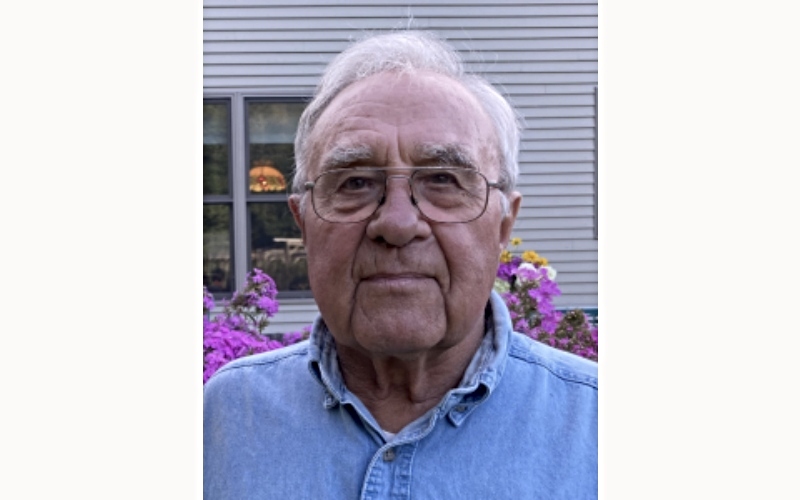
Cutline: Forester Tom Sweet worked for the US Forest Service and later for the Ward Lumber Company. He drove the map to VT from New York City on the top of his micro-bus!
If you’ve spent any time in the Mad River Valley Welcome Center lately, chances are you’ve found yourself standing in front of the map – leaning in, tracing ridgelines with your eyes, pointing out dirt roads you’ve driven and trails you’ve skied or hiked. It’s hard to miss. And as it turns out, it’s got quite a story.
The idea for a relief map first took shape while we were applying for a Vermont Outdoor Recreation Economic Collaborative (VOREC) grant. We were imagining what would make our Welcome Center feel more engaging, more Mad River Valley. A big, tactile relief map of The Valley felt like just the thing – something that would invite curiosity, conversation, and a sense of place.
When I floated the idea to Joshua Schwartz, director of the Mad River Valley Planning District, he said, almost offhandedly, “I think there’s one in Warren!”
An hour later, we were climbing into the attic of the Warren Town Hall. And sure enough, leaning against a wall, we found it: a four-by-eight-foot relief map of the Mad River Valley, covered in scratched plexiglass and a good layer of dust. When we pulled the plexiglass away, we realized just how special it was – an incredibly detailed topographic map with 100-foot elevation contours. Even better, its footprint perfectly matched the area covered by our Mad River Valley Recreation Map: from Granville to Middlesex along the Mad River, flanked by the spine of the Green Mountains and the Northfield Range.
At first glance, the map was mostly white, with timber lots carefully labeled, and all the major roads marked. The craftsmanship was unmistakable, and it was clearly old. But where had it come from? No one seemed to know.
Enter Dave Reid. Dave, an old friend and local artist with a deep love for The Valley, agreed to take on what quickly became a labor of love: bringing this forgotten map back to life. There were hints that it might be connected to the Ward Lumber Company, once a major landholder in the MRV (and the seller of the land that eventually became Mad River Glen). But despite asking around, no one had a definitive answer.
Dave got to work anyway. He trimmed down and refinished the wooden frame and made a key decision early on: this map wasn’t going back under glass. We wanted visitors to feel close to it – to experience it as something tactile and alive.
He began painting the landscape in layered greens, imagining The Valley in the fullness of summer. Using aerial imagery and an incredible eye for detail, Dave brought the terrain to life. Look closely and you’ll see the cliff bands near the summit of Camel’s Hump, the dramatic vertical walls of the Granville Gulf, and countless subtle features that feel unmistakably right if you know this place.
Paved roads are rendered in gray, dirt roads in brown. Recreational trails appear in red, including the Long Trail, Catamount Trail, VAST trails, and the Mad River Path – mirroring what you’ll find on our Recreation Map.
And then, in true Vermont fashion, the mystery unraveled by pure chance.
One day, my wife and I were walking along Mount Hunger Road in Waterbury Center when a gentleman stopped to chat after noticing my Mad River Glen T-shirt. He introduced himself as Tom Sweet, a forester who lived near the Hunger Mountain trailhead. When he casually mentioned knowing Leo Laferriere – legendary local forester – I knew we were talking to the real McCoy.
Tom told us about his work with the U.S. Forest Service out of Rochester, and on a whim I said, “Hey, total shot in the dark… you wouldn’t happen to know anything about a relief map we found in the Warren Town Hall, would you?”
He laughed. “The big one? Oh yeah. I know all about that.”
Turns out the map was commissioned in 1974 by a New York City outfit called the New England Land Syndicate (which, let’s be honest, sounds a little villainous). They were eyeing large tracts of Ward Lumber Company land as a potential development opportunity and hired a firm in NYC to create this incredibly accurate, detailed relief map.
Tom Sweet remembered that it was driven back to Vermont strapped to the roof of a VW microbus likely driven by Crosby Smith the general manager of “the syndicate.” This is about as 1970’s Vermont as it gets.
The deal never happened. The map sat in Sweet’s office for years. He tried, unsuccessfully, to donate it to places like Harwood Union High School. Eventually, it ended up at the Warren Town Hall, was moved to the attic… and forgotten.
Dave Reid has been working on the map for more than three years and continues to add trails and fine details. Thanks to his dedication, what was once a dusty relic is now the centerpiece of our Mad River Valley Welcome Center – a living, breathing testament to the land, history, and ingenuity of this community.
We’re incredibly grateful to Dave for his patience, skill, and vision. It’s pretty amazing to see this map find new life and new purpose after all these years. Around here, that kind of thing feels just right.
Good old Yankee ingenuity, indeed.